About the Area

Brief history, cultural significance, and natural features
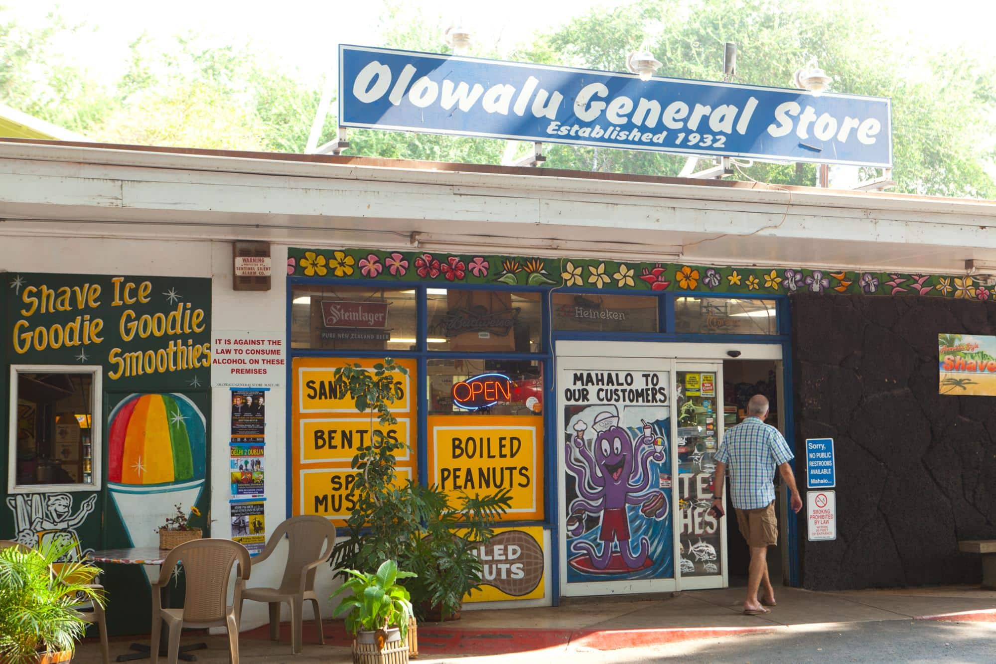
Olowalu is a small, quiet community on the leeward coast of Maui, just five miles south of Lahaina along the Honoapiʻilani Highway. Home to around 100 residents, this ʻāina carries deep historical and cultural significance.
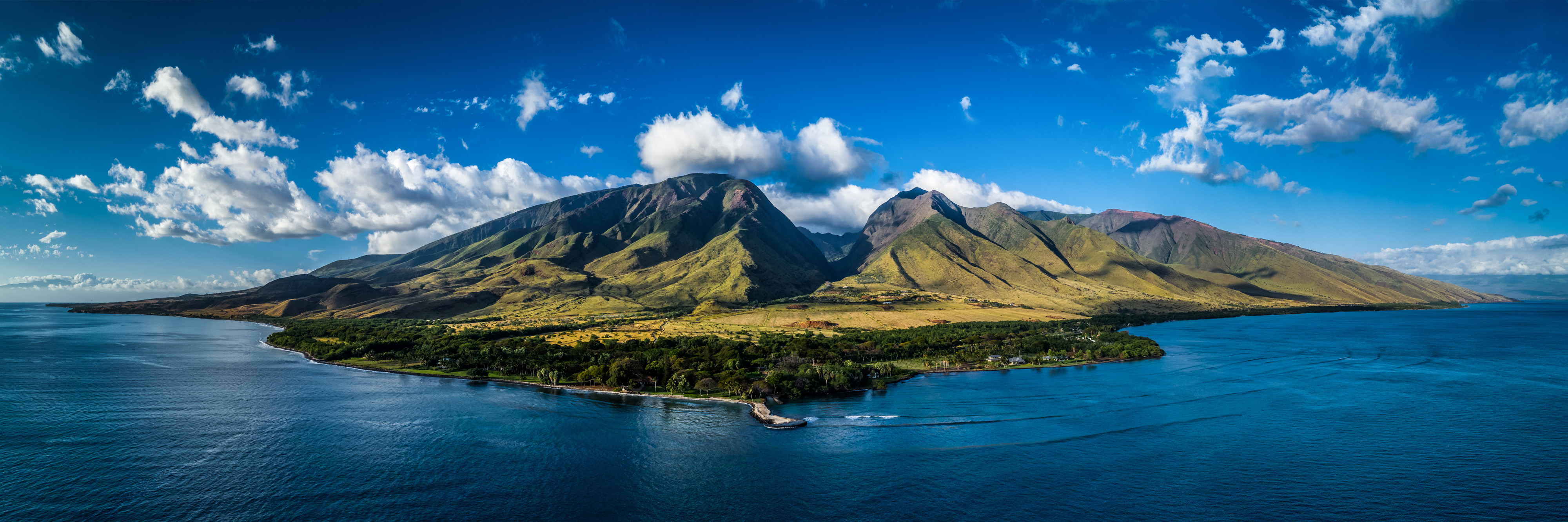
The ahupuaʻa spans from Puʻu Kukui, the highest point of the West Maui mountain ridgeline at 4,457 feet, to the lower valley that opens into a sloping alluvial plain. Neighboring ahupua‘a include Awahia to the west (Moku 'o Lahaina) and Ukumehame to the east (Moku 'o Kealaloloa).
Olowalu is traditionally recognized as a puʻuhonua, a sanctuary for anyone fleeing oppression. There is evidence of habitation, petroglyphs, personal shrines, and heiau for religious ceremonies, navigation, fishing, and other sacred purposes, stewarded by lineal descendants and local organizations.
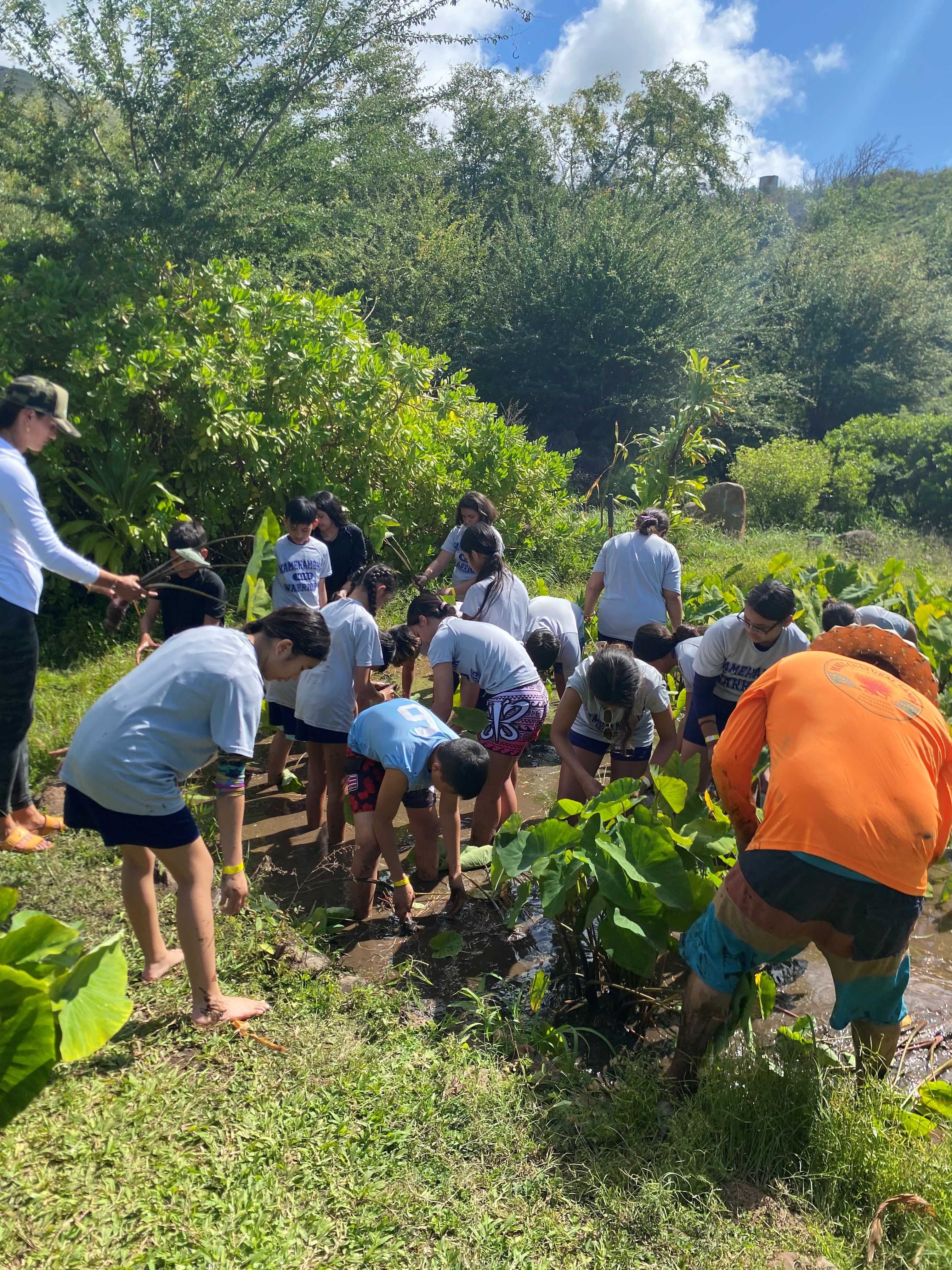
Loʻi kalo thrived along Olowalu Stream, while drier areas supported crops like kō (sugar cane), maiʻa (banana), and ʻuala (sweet potato), alongside important material plants such as kukui, wauke, ʻolona, pili, and naio. Olowalu was especially known for its dryland taro and abundant ʻulu groves. Crafters used resources to create canoes, nets, kapa, and other materials to sustain fishing, farming, and spiritual practices. When the Olowalu hills were cleared of ‘iliahi, koa, kou, and ‘ohi‘a hardwoods in the early 1800s, Olowalu Valley became a much drier environment mauka-makai and was eventually farmed for sugar.
The Olowalu and Ukumehame lowlands were once rich salt marshes and wetlands that sheltered seabirds, fish, and invertebrates, and supported native grasses and shrubs. Evidence of an inland fishpond named Ka Loko Kapaiki rests near the Olowalu shoreline.


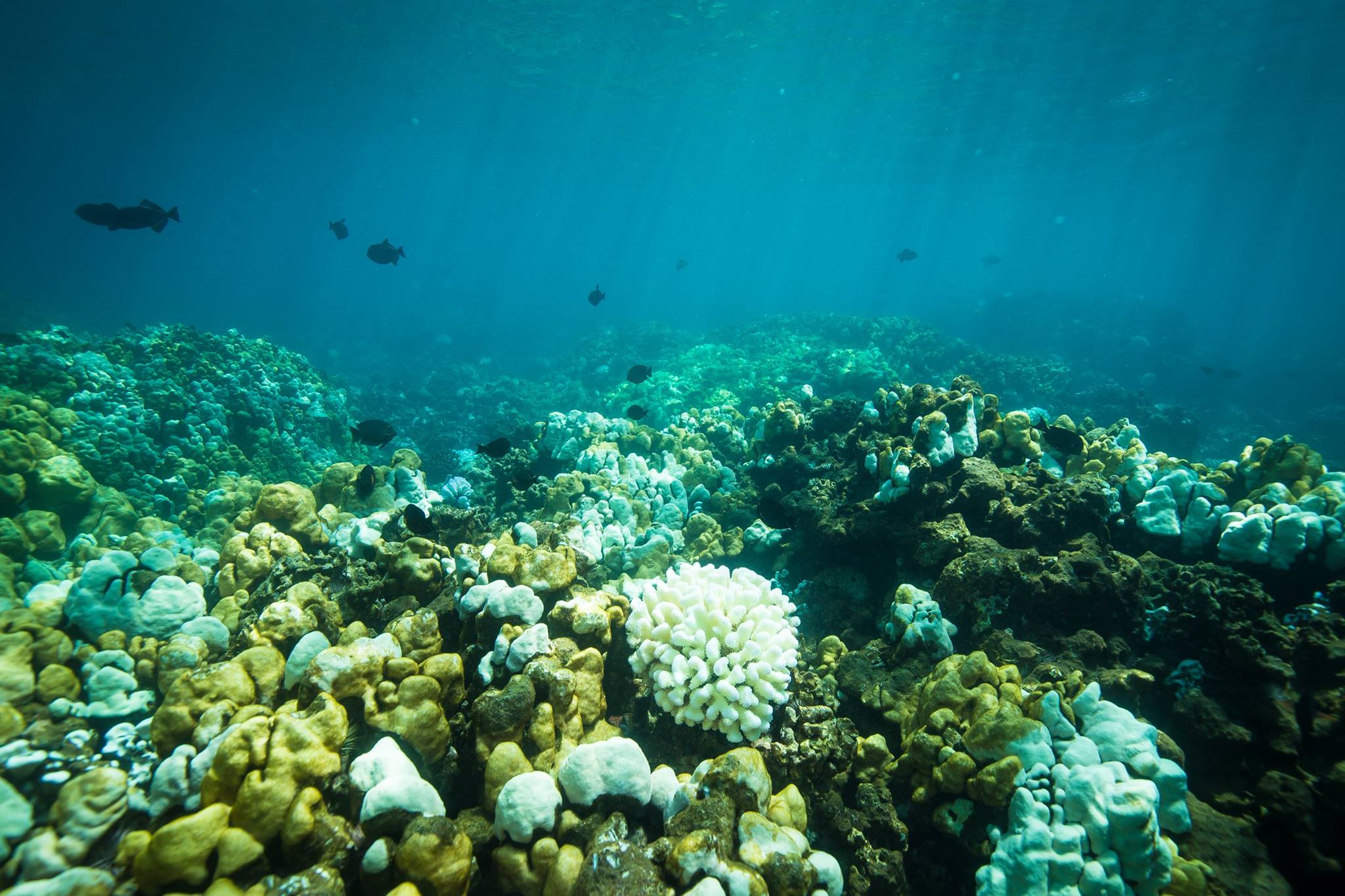
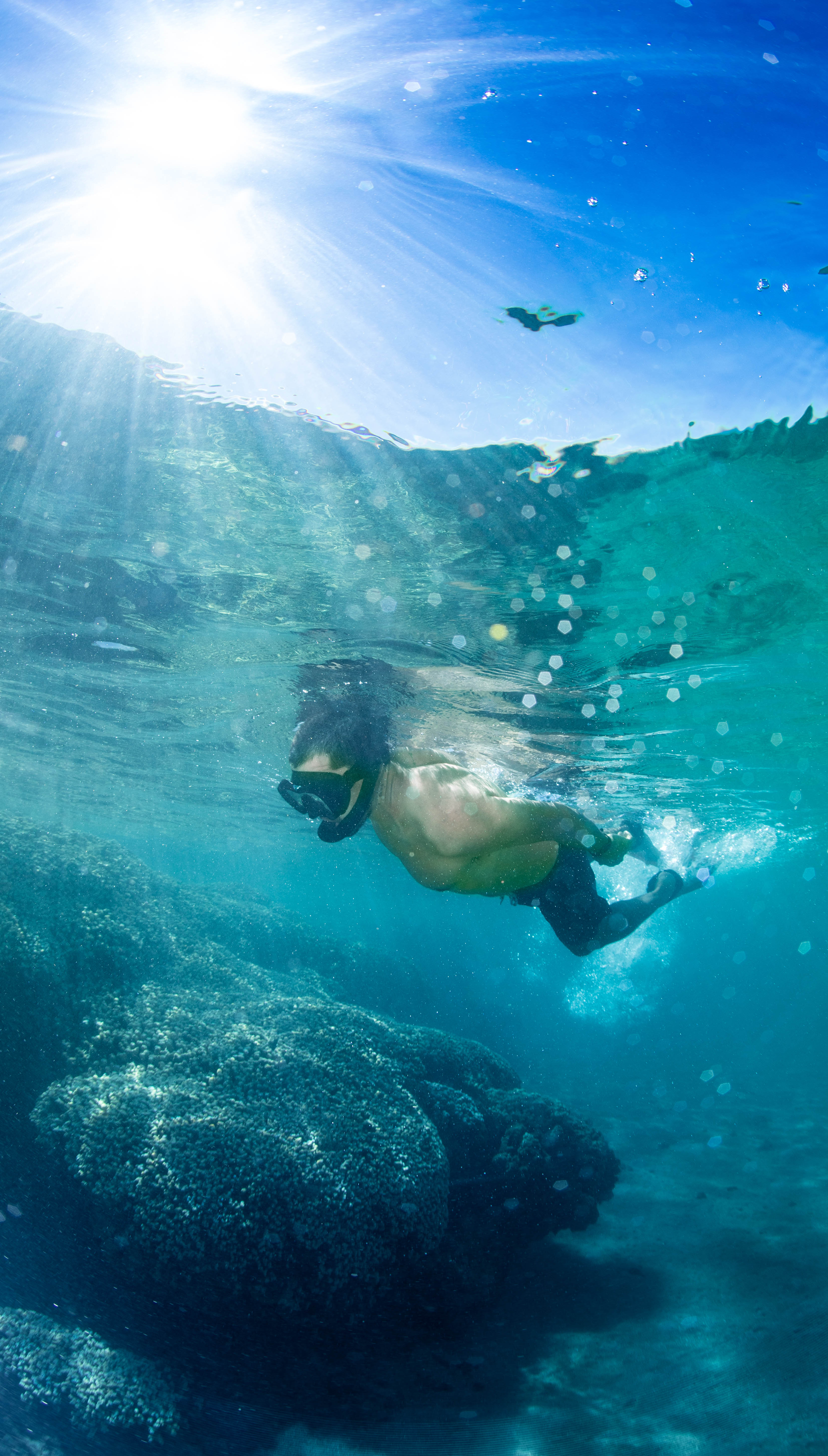
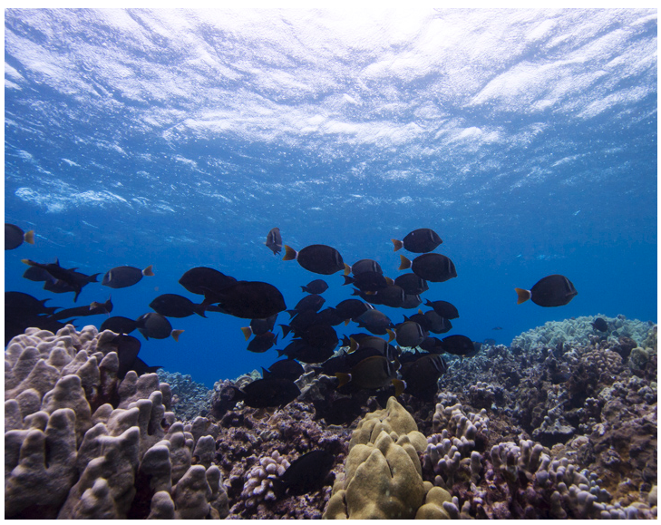
The inshore waters at Olowalu, Ke Kai o Haui, were renowned fishing grounds also abundant in octopus, sharks, turtle, and manta ray. Native Hawaiians speak to these species as familial relatives. Presently, these waters are home to a large population of manta rays and to the oldest coral in the main Hawaiian Islands, some over 600 years old. In 2017, the one-thousand-acre Olowalu Reef was designated as a Mission Blue “Hope Spot”.
Rich in rare and diverse coral species, Olowalu serves as a nursery for marine life and a lifeline for reefs throughout the region. Having earned the name “Mother Reef”, these ancient corals release spawn that travel on ocean currents to seed and restore reefs across Maui, Molokaʻi, and Lānaʻi, making Olowalu vital to the health of neighboring reef systems.
To learn more about the rich history of the Olowalu area, please check out the resources featured on our Resources and Data Hub page.
2025 Sediment Report
“Urgent action is needed to reduce erosion and restore habitats across the landscape.” From the TNC report, “Increasing Resilience of Coral Reefs and Coastal Communities in Olowalu, Maui, by Managing Land-Based Sediments.”
Read the ReportThreats and Hazards
Through the historic disconnection of people and ‘āina from changes in stewardship, land management, and climate changes, Olowalu is facing threats to the health of its ecosystems, both terrestrial and marine. The connection between ‘āina and kai has been severed, and the conservation and restoration efforts in Olowalu mauka-makai will work together to reconnect ocean and land-based ecosystems, fostering the health and healing of the place as a whole. The organizations represented by Pilina Olowalu aim to restore Olowalu’s historic connectivity and prosperity by addressing each of these threats, one effort at a time.
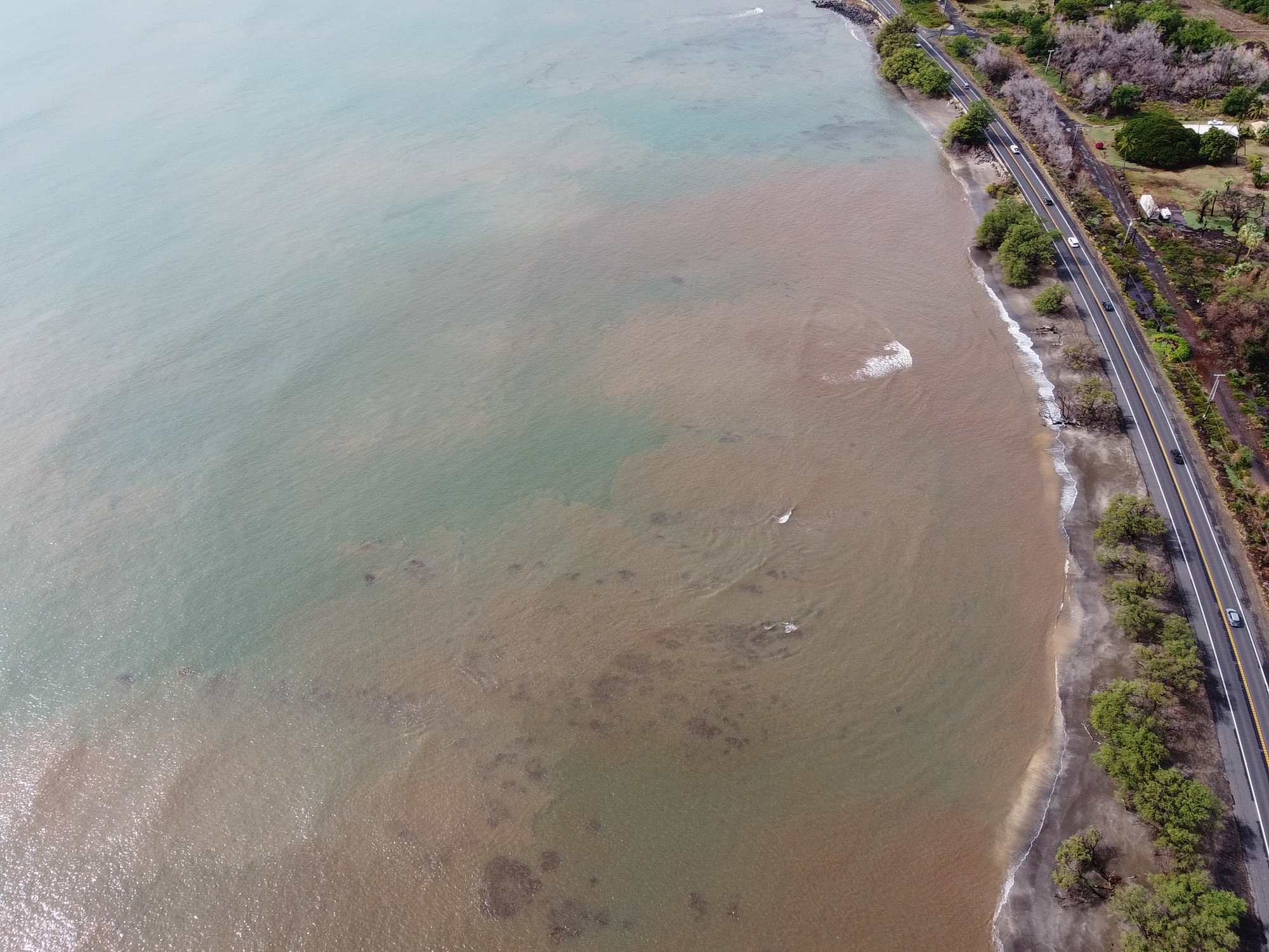
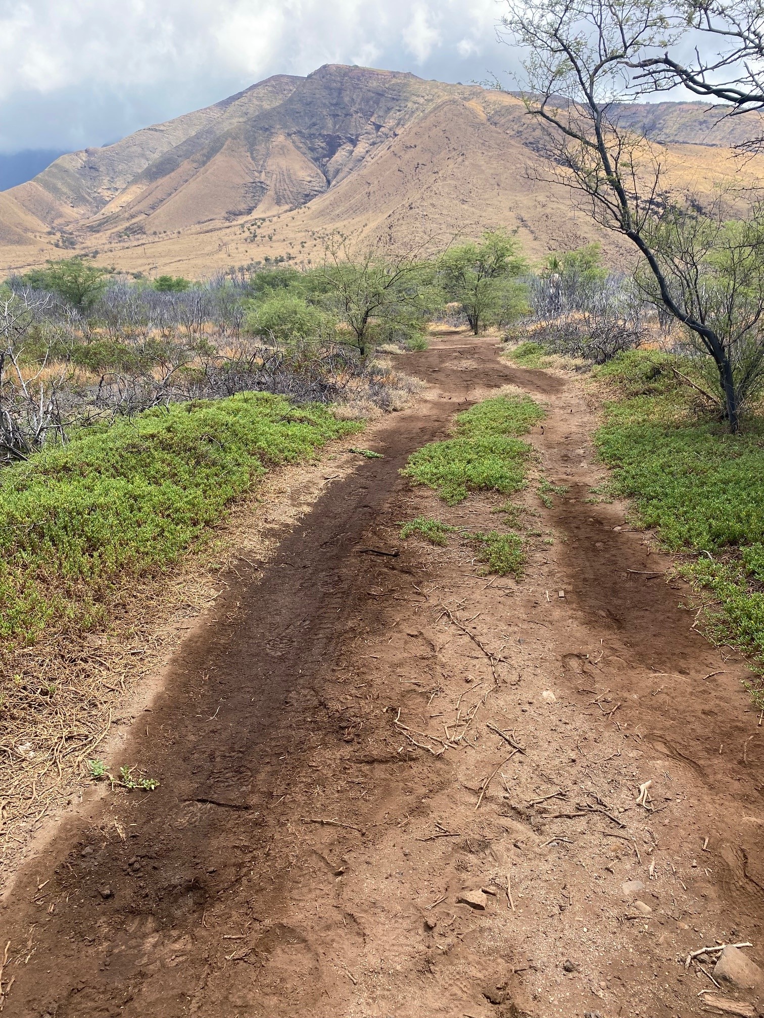
Upland erosion and sedimentation to the coral reef
In the uplands of Olowalu valley, native vegetation has decreased due to wildfires and grazing invasive ungulates, leading to increased erosion—a major source of the sediment that ends up on Olowalu reef. The loose soil travels from high elevations into gulches, especially during heavy rainfall, and existing sediment retention infrastructure is often insufficient to prevent excessive runoff from entering the ocean. “Brown water events” are when the water is made cloudy, or turbid, with dirt. Sediment can get trapped in areas where water movement is limited and resuspended during seasonal swells, which can starve corals of sunlight and smother corals once settled.
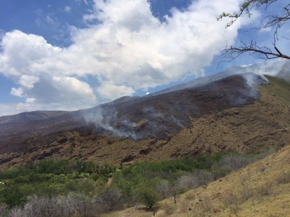
Wildfires
Wildfires in West Maui have increased in frequency due to climate change and extreme weather events, reducing vegetation. Coupled with loss of native vegetation due to invasive ungulates, fire-prone invasive plants have been able to take over which oftentimes further increases the risk of wildfires in both upland and coastal areas. In addition, when topsoil is exposed by fire, it is incredibly vulnerable to erosion by high winds or rain, leading to more sediments entering the ocean, harming the Olowalu reef.
Coastal habitat degradation
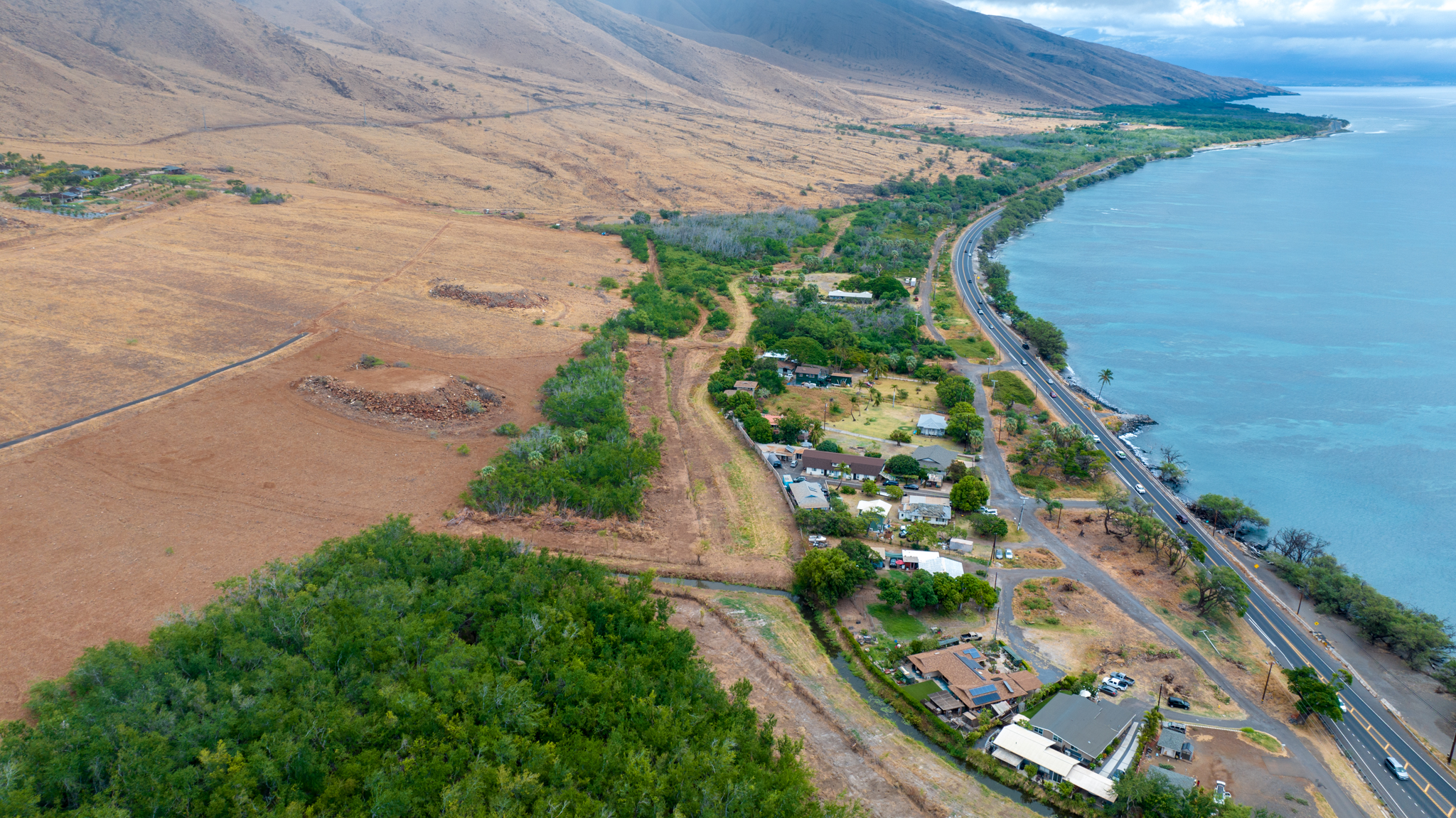
The lowland areas of Olowalu and Ukumehame were once wetlands that were home to native Hawaiian species and that naturally filtered stormwater and sediment. After being filtered by the wetlands, clean fresh water entered the oceans and nourished the reef ecosystem with nutrients and organic matter. Throughout the 20th century, land conversion and stream diversion for sugar plantations and ranching degraded and drained the historic wetlands. When the plantations closed, these areas were left fallow with crops replaced by invasive species. These wetlands once had both freshwater inputs from streams and saltwater inputs from tides, but the Honoapi‘ilani Highway has severed this connectivity. If wetlands along this shoreline were restored, the natural functions of sediment filtration and flood control could be strengthened.
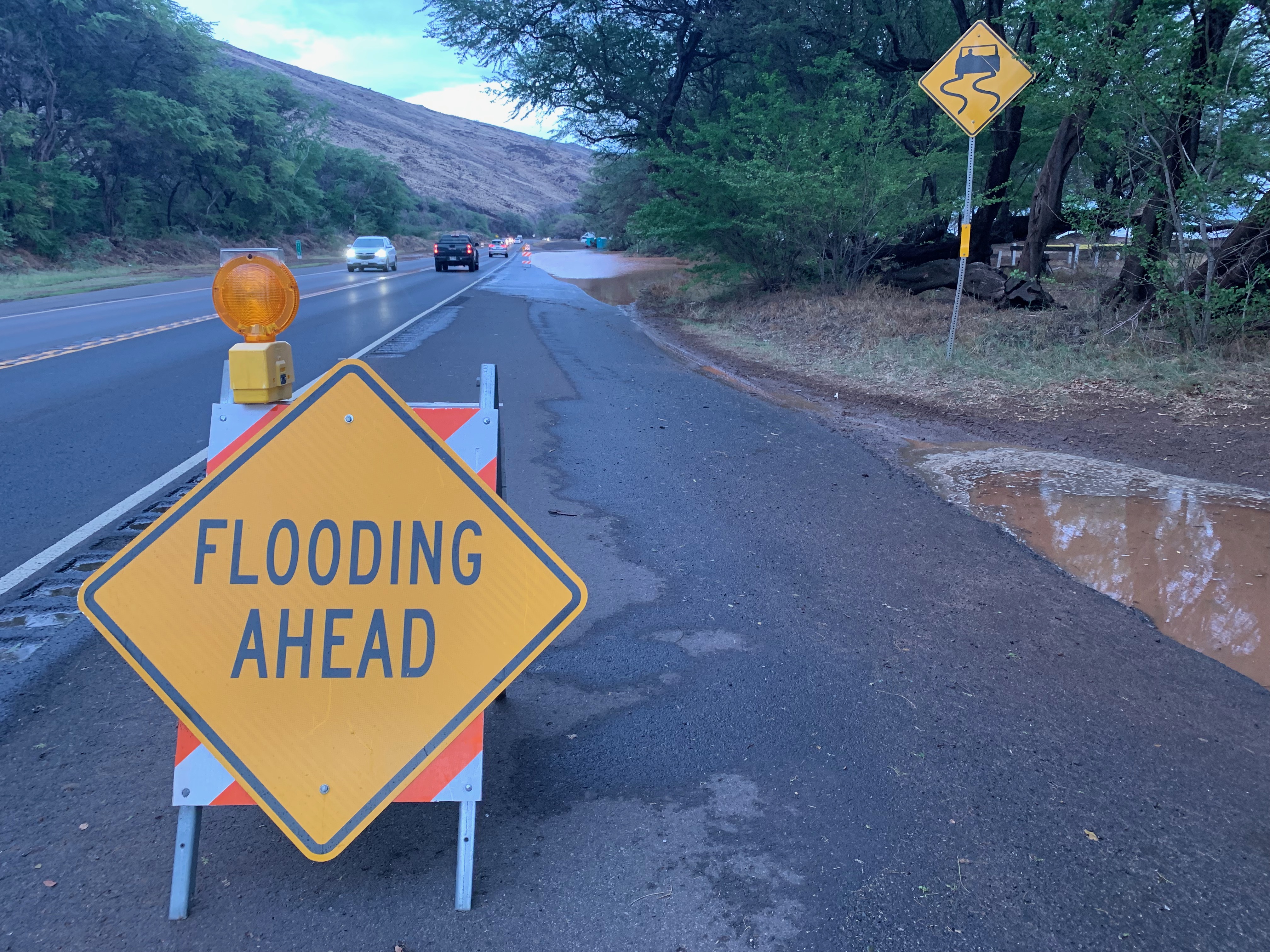
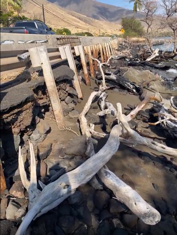
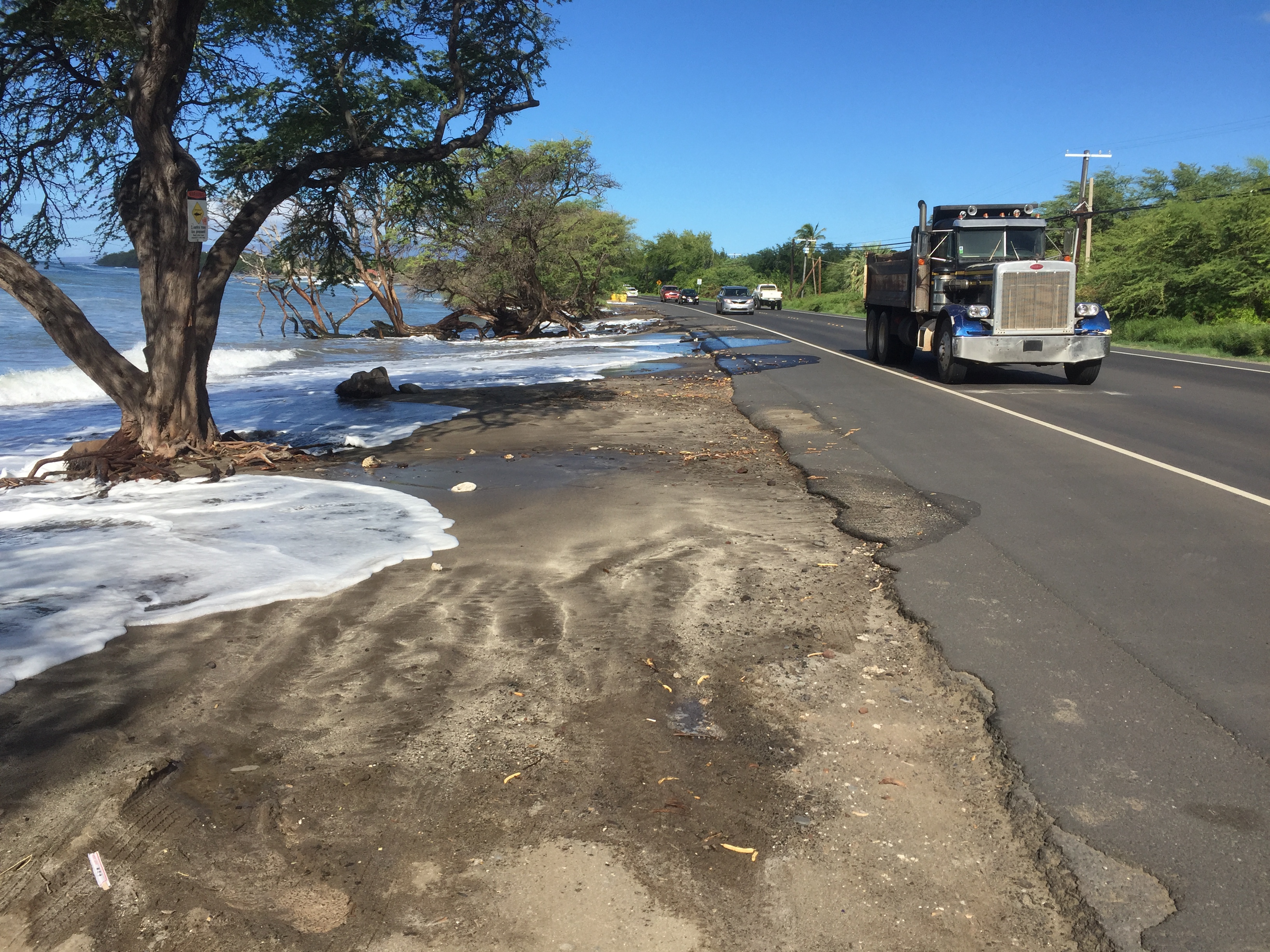
Highway vulnerable to coastal erosion and sea level rise
The coastal Honoapi‘ilani Highway faces threats from sea-level rise, coastal erosion, and periodic flooding. The frequency of flooding of the highway has increased in recent years, and erosion is apparent in many places along the road. In some areas, seawalls have been constructed to protect the highway, but this shoreline hardening has detrimental impacts on coastal and reef ecosystems. Due to safety concerns, the State of Hawai‘i will be realigning the highway inland, which will create the opportunity for restoration in the coastal zone.
Climate change and coral bleaching
Corals in the Olowalu reef are facing stress from warming sea surface temperatures due to global warming. When corals get too warm, they expel the algae that live inside them and provide them with color and energy. This is what makes them turn white in color, or “bleached,” and it causes the coral to starve. Corals can recover from bleaching, but being in an environment with poor water quality, such as Olowalu after a large sediment influx, makes it much more difficult.
When waves are breaking, Olowalu is a popular surf and bodyboard spot.
People and Place
Today, the Olowalu-Ukumehame area is beloved by local families and visitors alike for its natural beauty, abundant reefs, protected beaches, trails, and more. The local community depends on the health of this coastline for subsistence practices and to preserve the cultural lifeways that Native Hawaiians have practiced throughout the area for centuries. More recently, Olowalu and Ukumehame have become popular destinations for surfing, snorkeling, whale-watching, and other recreational activities. To avoid overuse of the area, a balance must be struck between recreating in this place and protecting and respecting cultural and natural systems, which are already vulnerable. This will help to preserve the health of the ecosystems, traditional practices, and local enjoyment of the area.
Native Hawaiian Traditional Practices
Native Hawaiian traditional subsistence practices such as fishing and gathering food from the ocean, agroforestry, and loʻi kalo historically depended on this area. The continuation of these traditional practices has been threatened by resource degradation and the disconnection between people and ‘āina—the result of far-reaching changes in stewardship, land management, and climate. Some Olowalu-Ukumehame lineal descendants have renewed and restored these practices and are working to see their rights respected and protected by creating areas designated for these practices.
Agriculture
Historically this area was rich in agriculture and fed the local community. Land-use changes during the plantation era altered the landscape, soil health, and resource availability. Today, portions of former agricultural lands have transitioned to housing and the remaining cultivated lands support regenerative agriculture, native Hawaiian plant propagation, subsistence farming, and the farming of pigs, sod, coconut, and other types of crops. Private residences also grow traditional food crops and crafting materials. One of the main concerns affecting the present status and future of agriculture in this area is soil health. Community efforts in regenerative and traditional farming practices are helping to rebuild the soil and improve food security. For example lo‘i kalo reduce the impacts of storms by retaining water and sediments, while absorbing nutrients that are beneficial to soil but detrimental to the coral reef.
Recreation
The Olowalu reef attracts snorkelers, divers, fishermen, and other recreational users with its relative abundance and diversity of coral and fish. You can often find kayakers and paddleboarders enjoying the normally calm waters of Olowalu, as well as surfers enjoying the surfbreak at Ukumehame and Awalua. This area is also popular for beach camping and hiking starting at the Lahaina Pali trail from Ukumehame to Māʻalaea. Olowalu-Ukumehame is deserving of respect from all who enjoy this special place. Because of the area’s popularity, many local organizations are promoting these respectful behaviors:
- share the beach with others
- wear reef-safe sunscreen while recreating in the ocean
- ensure a safe distance from any marine wildlife, including corals
- standing on coral reefs causes damage to reef health
- while on land, stay on marked trails and always leave no trace
Residential
Olowalu (Kapāiki) and Ukumehame are home to many local families, roughly 100 residents, with more development on the horizon. Community members are concerned about water availability and use, increased traffic, the development of new infrastructure and current infrastructure capacity, ecosystem health, and resource depletion due to potential over-development. The resiliency of this area depends on the careful consideration of how to approach the potential growth of the Olowalu-Ukumehame area without compromising the ecological balance for future generations.
Fishing
Olowalu’s reef has long fed families and sustained cultural practices like throw net, pole fishing, and spear fishing. Its abundance is why so many continue to fish here today, for both subsistence and recreation. At the same time, the reef is delicate and showing signs of strain, reminding us that what we take has real impact. Ancestral and contemporary sciences point to the need for balance so fish populations and reef health can recover and thrive. This creates an opportunity for thoughtful marine stewardship that honors cultural subsistence while guiding responsible use. By fishing with care and kuleana, we help ensure Olowalu-Ukumehame remains a place of nourishment and connection for generations to come.
Transportation and Infrastructure
Olowalu’s transportation and infrastructure systems support daily life while shaping the health of the surrounding environment. A refuse and recycling center plays an important role in reducing waste and protecting the reef from land-based pollution. The Honopiʻilani Highway, a vital highway connecting communities, is now facing the realities of sea-level rise and coastal erosion. With plans to move the highway inland beginning in 2027, there is a meaningful opportunity to restore the shoreline and reestablish natural coastal functions. Government agencies, decision-makers, and community insight together with environmental ‘ike can best guide this transition to ensure that both access and environmental care are upheld. This moment invites us to think forward, strengthening connections between people, place, and the long-term resilience of Olowalu-Ukumehame.


